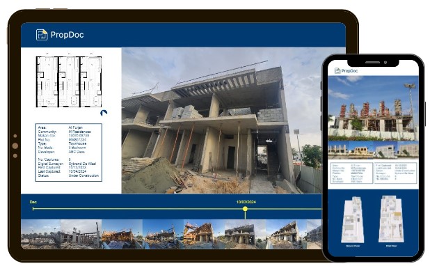
Track the progress of the build
with our digital reporting
solution. We capture the
project as often as required
and upload the time-stamped
footage for you to view
anytime & anywhere.
Monitor progress with two
methods, either visual or an
engineering audit process.
Login and view the progress
remotely. Share the results
with others involved in the
project.
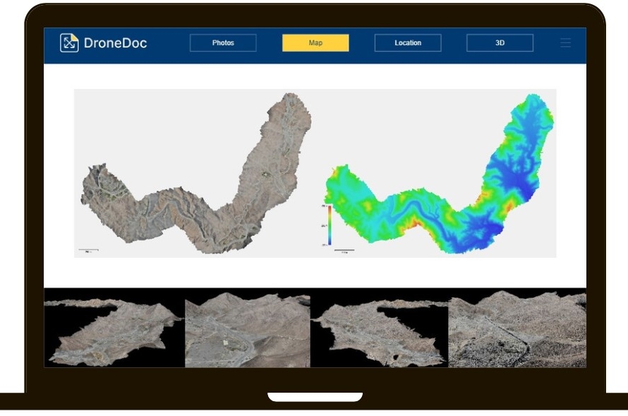
Aerial mapping by drone offers
the advantage of effortlessly
obtaining high quality data.
Drones can be equipped with
the necessary tools for each
specific task, allowing for a
customisable drone platform,
delivering optimal results.
Aerial imagery and precise
mapping can replace
conventional 3D measurement
tools and sensing equipment.
Therefore a survey-grade
drone is significantly more
efficient compared to using
traditional tools.
Unmanned Aerial Vehicles
(
UAVs) are cost-effective to
operate, can be deployed
instantly, and can be
pre-programmed to follow
specific routes via waypoint
grids. Furthermore, the
captured data is stored in a
format that seamlessly
integrates software for
geo-mapping, enabling fast
data implementation.
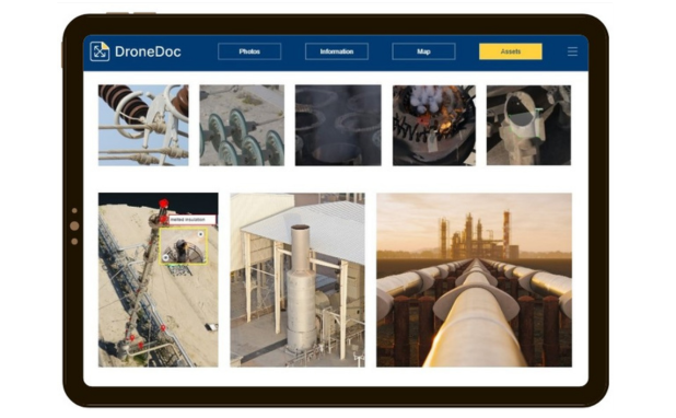
Use drones to inspect
buildings, infrastructure,
power lines, wind turbines or
waterways. Drones are making
inspections much safer, easier
and cheaper. Drones eliminate
the need for large machinery
such as cherry pickers,
hydraulic cranes or platforms
and avoid any type of rope
descent making the
inspections much safer.
Maintenance and inspection
services struggle with
covering large areas occupied
by structures. They need
meticulous inspections for
proper maintenance, but
conducting physical
examinations of each
component is slow and incurs
expenses.