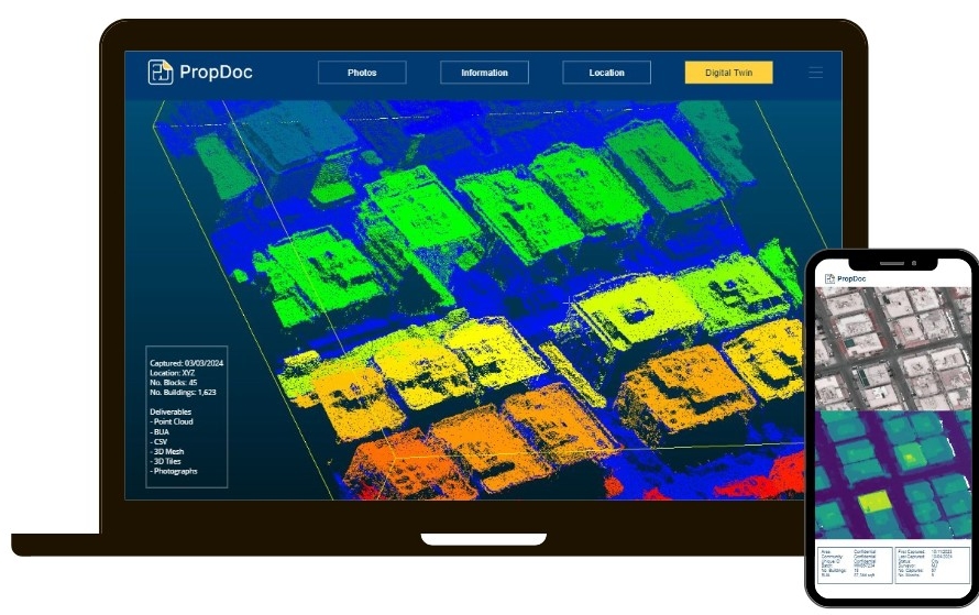
We capture using a range of
LiDAR scanners and deliver
point cloud data in a variety of
formats & densities. Our team
of Digital Surveyors can
capture point cloud data from
the ground and air.
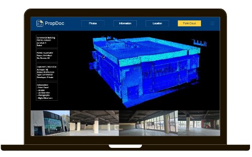
PropDoc offers a turnkey
solution to convert heavy
point cloud data into simple
2D & 3D assets. Alternatively,
if you prefer to handle the
data we can
capture-as-a-service on your
behalf.
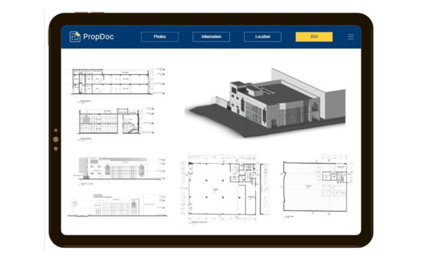
We offer BIM modeling
services. Provide us the
datasets and the scope of
work and we handle the
process. Save time and
resources, as we model to the
required LOD.
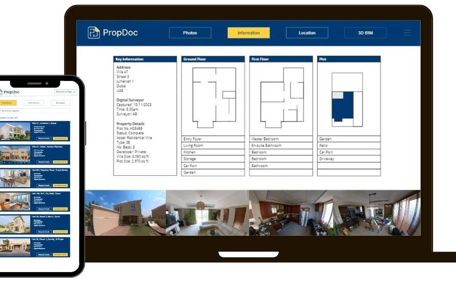
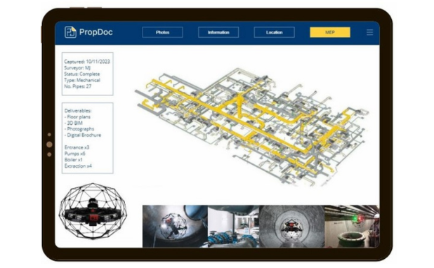
Keeping a digital log of your
assets is now critical to teams
working in multiple locations.
This allows you to upload
documents and remotely
access them on the go, with
the ability to share to key
personnel. Contact us to find
out more.
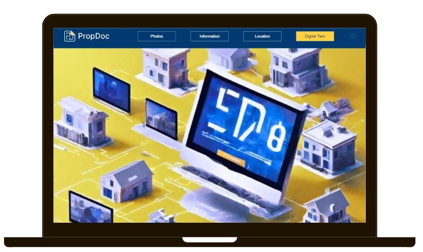
Smart buildings are generating
big savings and increasing
asset values. Take our 3D
models and integrate them
with digital twin capabilities.
BIM is only the beginning for
digital twins. Adopting sensors
and using software, you can
track and remotely control
your assets’ digital twin.
Contact us to find out more.
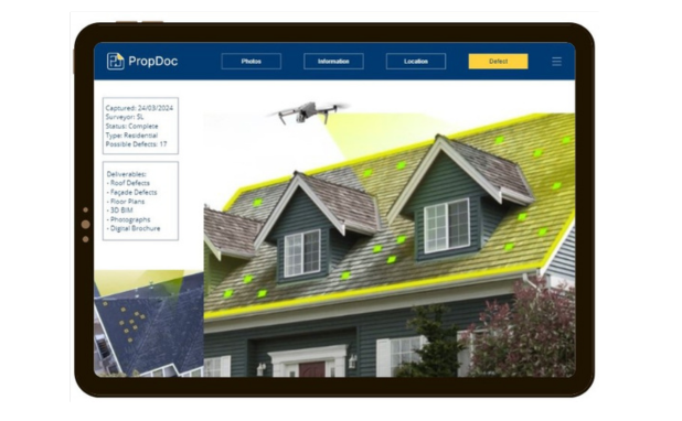
DroneDoc scans the asset,
and the software flags
possible defects and creates a
bespoke report.
Identify defects both
externally and internally. We
use advanced technology to
build solutions for the
property sector.
Do you need to know the
built-up area of an entire city?
Or a sub-community or just a
specific building?
DroneDoc’s innovative solution
using computer vision and
machine learning.
Using drone or satellite
footage, our solution
automatically segments each
building and calculates the
built-up area of each building.
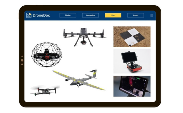
We supply industry-grade
drones to the local market.
Our team of pilots can offer
training and support for UAV’s
and software. Contact us to
find out more.
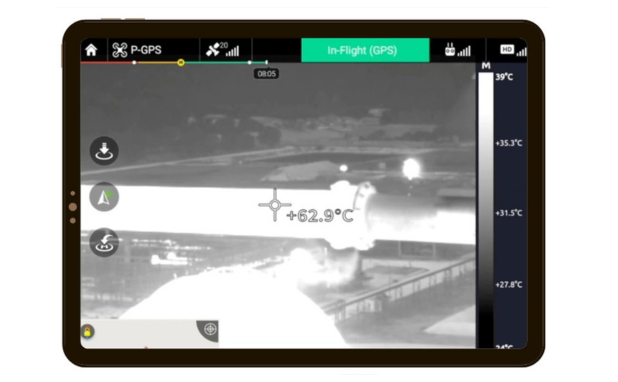
Keep people safe with the use
of UAV and optical gas
imaging technology. Monitor
and visualize gas leaks quickly
and safely, avoiding the risk of
endangering your team of
inspectors.
Utilizing drones for thermal
inspections is becoming
increasingly common due to
the clear benefits:
– Cost-effective
– Human safety
– Real-time results
– Faster turnaround
– Accurate readings
Thermal cameras can detect
differences of 0.1C in
temperature whilst
simultaneously provide high
quality image overlays for
remote asset inspections to
occur.
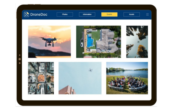
We can assist with aerial
footage of corporate events,
weddings or promotional
adverts. Reach out to find out
more.
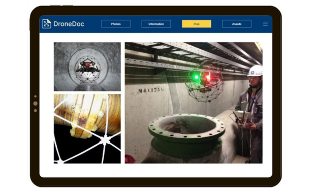
We offer a collision-tolerant
drone inspection service
designed for dangerous areas.
Remotely access & map
pipelines, shafts, tunnels and
other hazardous
environments. Detect issues
and keep people safe.
Navigate complex areas with
our drone services.
A turnkey scan-to-BIM
solution, DroneDoc is
digitizing the physical world.
Using LiDAR scanners, our
Digital Surveyors scan the
asset and we produce BIM
models to any Level of Detail
required.
Whether you just need general
arrangement floor plans, or a
detailed 3D BIM model,
DroneDoc takes care of it.